Related Images


Download:
| Tiny | 228x128 | View | Download |
| Small | 456x256 | View | Download |
| Medium | 912x512 | View | Download |
| Large | 1825x1024 | View | Download |
| Original | 2245x1259 | View | Download |
This image was acquired from
wikimedia. It was marked as Public Domain or CC0 and is free to use. To verify, go to the source and check the information there.
Looking for more info about this image?
Try a Google Reverse Image Search for it.
Try a Google Reverse Image Search for it.
Keywords from Image Description:
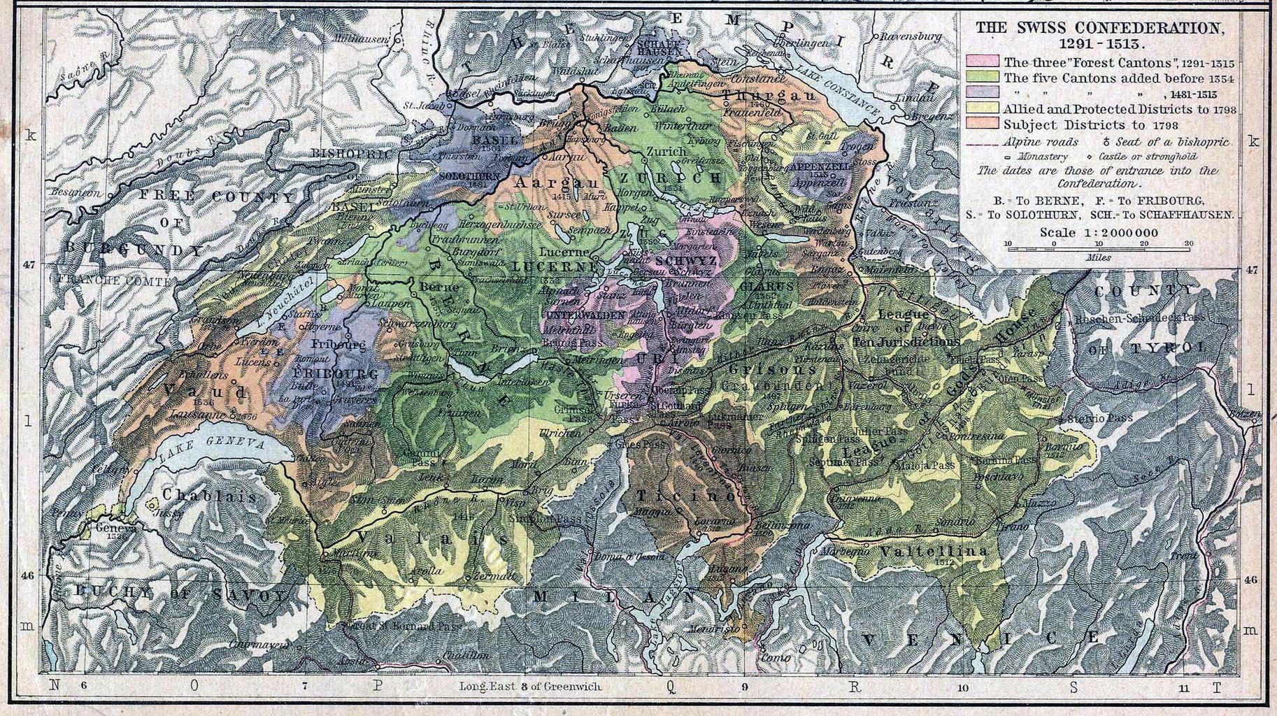
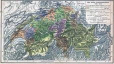
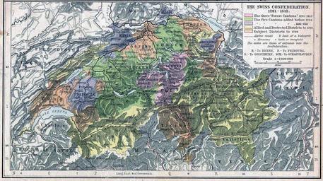
Swissconfederationshepherdatlas x. Historical map showing the growth of the Old Swiss Confederacy Switzerland The map is not very accurate there are some errors The yellow area for Valtellina reaches to far to the south Shepherd William Historical Atlas New York Henry Holt and Company revised by wolpertinger original version