
Related Images


Download:
| Tiny | 135x128 | View | Download |
| Small | 270x256 | View | Download |
| Medium | 540x512 | View | Download |
| Large | 1080x1024 | View | Download |
| Original | 4544x4305 | View | Download |
This image was acquired from
wikimedia. It was marked as Public Domain or CC0 and is free to use. To verify, go to the source and check the information there.
Looking for more info about this image?
Try a Google Reverse Image Search for it.
Try a Google Reverse Image Search for it.
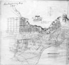
Keywords from Image Description:
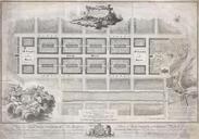
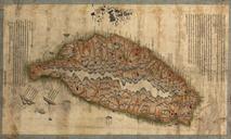
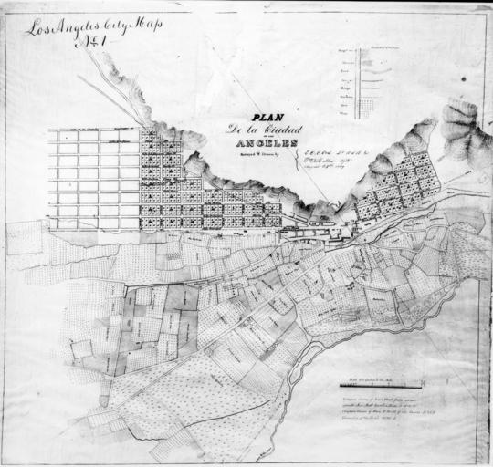
The E.O.C. Ord's first map of the city of Los Angeles drawn in August CHS. Photograph of the Ord's first map of the city of Los Angeles drawn in August The grid up north near the mountains represent downtown Los Angeles The blocks in downtown Los Angeles are further divided into numbered sections The lower half of the map represents