
Related Images
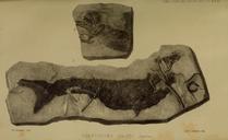

Download:
| Tiny | 75x128 | View | Download |
| Small | 150x256 | View | Download |
| Medium | 300x512 | View | Download |
| Large | 601x1024 | View | Download |
| Original | 1207x2055 | View | Download |
This image was acquired from
wikimedia. It was marked as Public Domain or CC0 and is free to use. To verify, go to the source and check the information there.
Looking for more info about this image?
Try a Google Reverse Image Search for it.
Try a Google Reverse Image Search for it.
Keywords from Image Description:
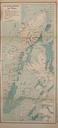
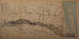
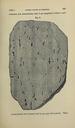
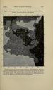
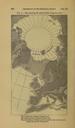
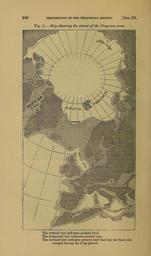
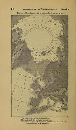
The Quarterly journal of the Geological Society of London . PROCEEDIIirGS OF THE IOLOGICAL SOCIETT Jan Fig Map showing the extent of the Cragsea area The vertical tint indicates ancient land The horizontal tint indicates ancient seas The inclined tint indicates present land that has not been sub merged during the Crag period