Related Images


Download:
| Tiny | 308x128 | View | Download |
| Small | 616x256 | View | Download |
| Original svg | 800x332 | View | Download |
| Original as jpg | 800x332 | View | Download |
This image was acquired from
wikimedia. It was marked as Public Domain or CC0 and is free to use. To verify, go to the source and check the information there.
Looking for more info about this image?
Try a Google Reverse Image Search for it.
Try a Google Reverse Image Search for it.
Keywords from Image Description:
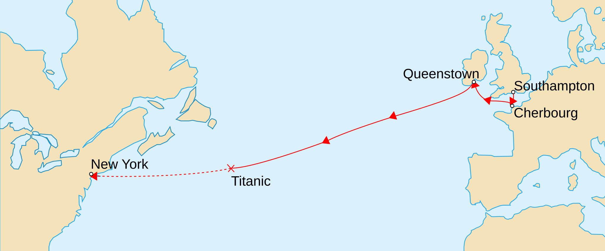
TitanicRoute.svg Map marks the route of RMS Titanic during her maiden voyage the ports on that route and approximate location of where she sank on The remaining portion of her uncompleted route is shown dashed Version vectorielle de Image TitanicRoute RMS Titanicin neitsytmatkan reitti Yhteninen viiva kuvaa toteutunutta reitti