
Related Images


Download:
| Tiny | 454x128 | View | Download |
| Small | 909x256 | View | Download |
| Medium | 1819x512 | View | Download |
| Large | 3639x1024 | View | Download |
| Original | 22539x6341 | View | Download |
This image was acquired from
wikimedia. It was marked as Public Domain or CC0 and is free to use. To verify, go to the source and check the information there.
Looking for more info about this image?
Try a Google Reverse Image Search for it.
Try a Google Reverse Image Search for it.
Keywords from Image Description:
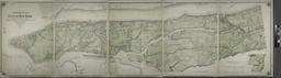
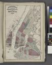
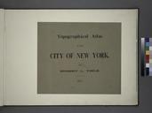
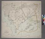
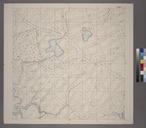
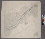
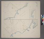
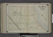
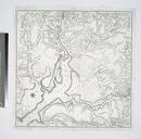
Topographical atlas of the city of New York. Topographical atlas of the city of New York including the annexed territory showing original water courses and made land Atlases of New York city Topographical atlas of the city of New York including the annexed territory showing original water courses and made land prepared under the