Related Images


Download:
| Tiny | 76x128 | View | Download |
| Small | 153x256 | View | Download |
| Medium | 307x512 | View | Download |
| Large | 614x1024 | View | Download |
| Original tiff | 4202x7000 | View | Download |
| Original as jpg | 4202x7000 | View | Download |
This image was acquired from
wikimedia. It was marked as Public Domain or CC0 and is free to use. To verify, go to the source and check the information there.
Looking for more info about this image?
Try a Google Reverse Image Search for it.
Try a Google Reverse Image Search for it.
Keywords from Image Description:
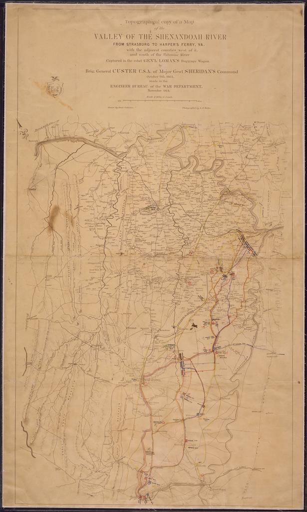
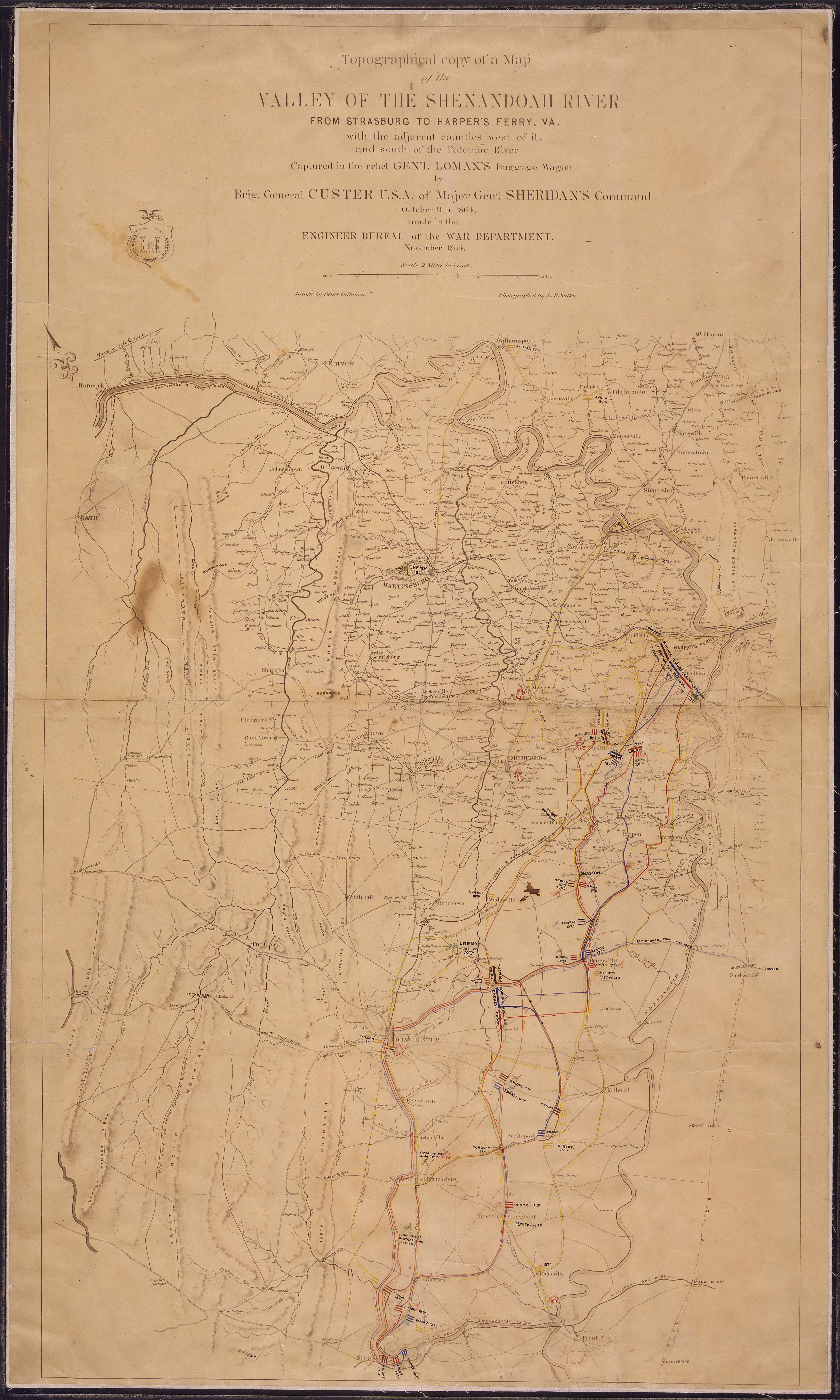
Topographical copy of Map of the Valley of the Shenandoah River From Strasburg Va. to Harper's Ferry. W. Va.... NARA .tif Scope and content Topographical copy of Map of the Valley of the Shenandoah River From Strasburg Va to Harper's Ferry Va with the adjacent counties west of it and south of the Potomac River Captured in the rebel