
Related Images


Download:
| Tiny | 137x128 | View | Download |
| Small | 275x256 | View | Download |
| Medium | 551x512 | View | Download |
| Original png | 767x712 | View | Download |
| Original as jpg | 767x712 | View | Download |
This image was acquired from
wikimedia. It was marked as Public Domain or CC0 and is free to use. To verify, go to the source and check the information there.
Looking for more info about this image?
Try a Google Reverse Image Search for it.
Try a Google Reverse Image Search for it.
Keywords from Image Description:
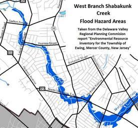
West Branch Shabakunk Flood Hazard Areas. en Map of flood hazard areas along the West Branch Shabakunk Creek in Ewing Township produced by the Delaware Valley Regional Planning Commission in its report Environmental Resource Inventory for the Township of Ewing Mercer County New Jersey dvrpc org pdf Delaware Valley Regional