Related Images


Download:
| Tiny | 210x128 | View | Download |
| Small | 420x256 | View | Download |
| Medium | 840x512 | View | Download |
| Large | 1680x1024 | View | Download |
| Original | 3315x2020 | View | Download |
This image was acquired from
wikimedia. It was marked as Public Domain or CC0 and is free to use. To verify, go to the source and check the information there.
Looking for more info about this image?
Try a Google Reverse Image Search for it.
Try a Google Reverse Image Search for it.
Keywords from Image Description:
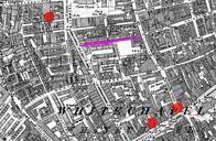
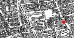
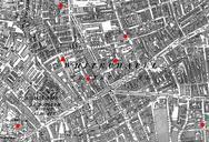
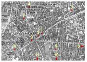
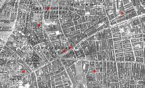
Whitechapel Spitalfields murders. Streetmap showing the locations of the first seven en Whitechapel murders Ordnance Survey Map of Whitechapel downloaded from casebook org Cropped and annotated with seven red dots to show the location of seven murders attributed to Jack the Ripper Ordnance Survey modified by User modified