
Related Images


Download:
| Tiny | 194x128 | View | Download |
| Small | 388x256 | View | Download |
| Medium | 777x512 | View | Download |
| Large | 1555x1024 | View | Download |
| Original png | 1601x1054 | View | Download |
| Original as jpg | 1601x1054 | View | Download |
This image was acquired from
wikimedia. It was marked as Public Domain or CC0 and is free to use. To verify, go to the source and check the information there.
Looking for more info about this image?
Try a Google Reverse Image Search for it.
Try a Google Reverse Image Search for it.
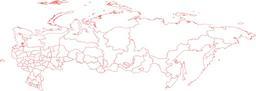
Keywords from Image Description:
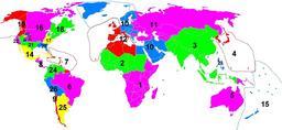
World administrative levels. Blank Map World Secondary Political Divisions svg Map of the world administrative levels from the database that am continually assembling The color schema is Level country boundaries countries solid px black Level countries solid px blue Level countries solid px brown Level countries solid px