
Related Images
Download:
| Tiny | 174x128 | View | Download |
| Small | 348x256 | View | Download |
| Medium | 696x512 | View | Download |
| Large | 1393x1024 | View | Download |
| Original | 5770x4240 | View | Download |
This image was acquired from
wikimedia. It was marked as Public Domain or CC0 and is free to use. To verify, go to the source and check the information there.
Looking for more info about this image?
Try a Google Reverse Image Search for it.
Try a Google Reverse Image Search for it.
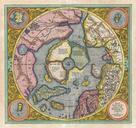
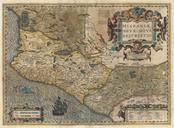
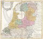
Keywords from Image Description:
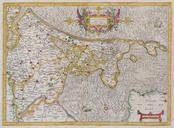
Mercator Map of Holland Netherlands Geographicus Hollandtmercator. rare and beautiful map of Holland Netherlands by Gerard Mercator Amsterdam appears at the center and the map extends south as far as Harderwyck and west as far as Rhenen and Rotterdam The Zuyder Zee now damned inland waterway occupied the lower center of the