
Related Images


Download:
| Tiny | 148x128 | View | Download |
| Small | 297x256 | View | Download |
| Medium | 594x512 | View | Download |
| Large | 1188x1024 | View | Download |
| Original | 6950x5989 | View | Download |
This image was acquired from
wikimedia. It was marked as Public Domain or CC0 and is free to use. To verify, go to the source and check the information there.
Looking for more info about this image?
Try a Google Reverse Image Search for it.
Try a Google Reverse Image Search for it.
Keywords from Image Description:
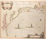
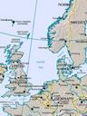
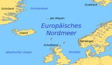
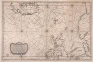
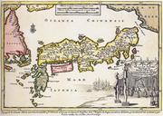
map Pieter Goos northsea norwegian sea. De Custen van Noorwegen Finmarcken Laplandt Spitsbergen Ian Mayen Eylandt Yslandt als mede Hitlandt en een gedeelte van Schotlandt de Karte von Pieter Goos zeigt Nordsee und Europisches Nordmeer samt den angrenzenden Ksten en Map by Peter Goos shows Norwegian Sea North Sea and adjacent coasts