Related Images


Download:
| Tiny | 153x128 | View | Download |
| Small | 306x256 | View | Download |
| Medium | 613x512 | View | Download |
| Large | 1227x1024 | View | Download |
| Original | 3678x3068 | View | Download |
This image was acquired from
wikimedia. It was marked as Public Domain or CC0 and is free to use. To verify, go to the source and check the information there.
Looking for more info about this image?
Try a Google Reverse Image Search for it.
Try a Google Reverse Image Search for it.
Keywords from Image Description:
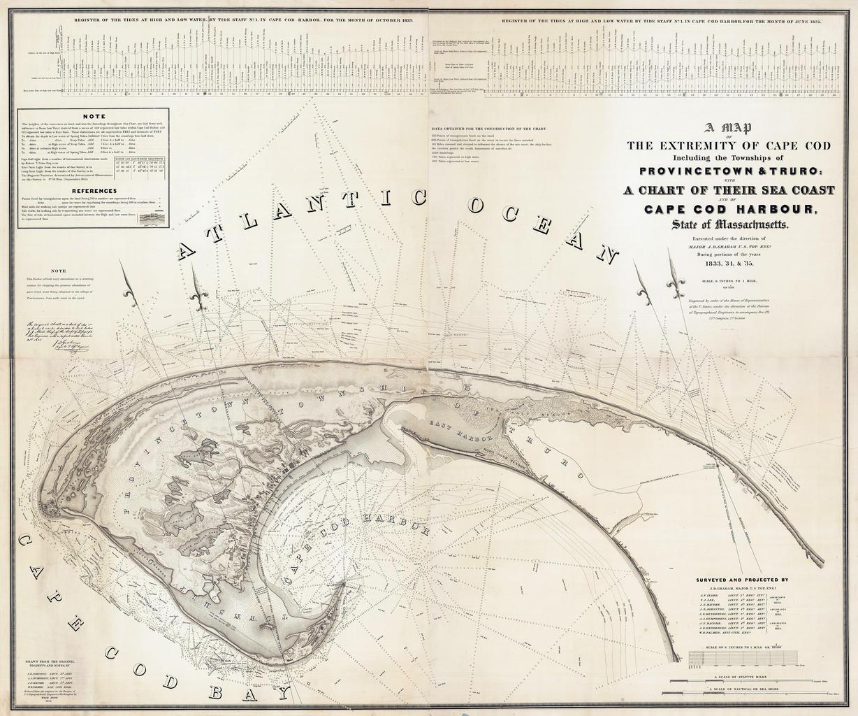
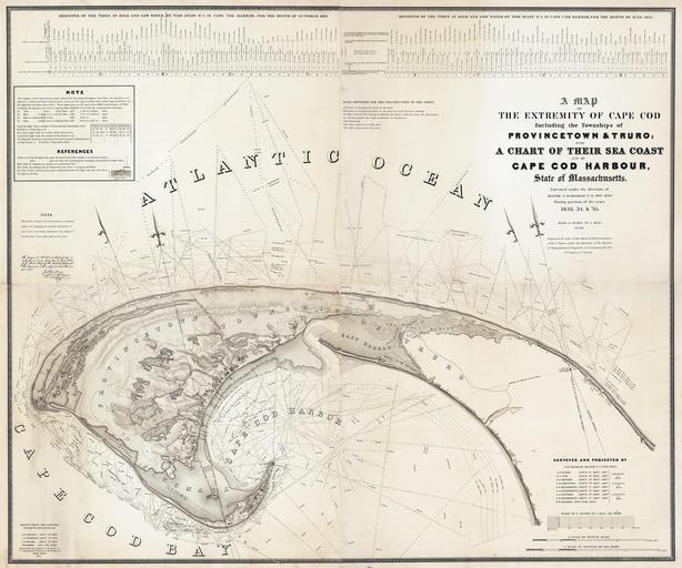
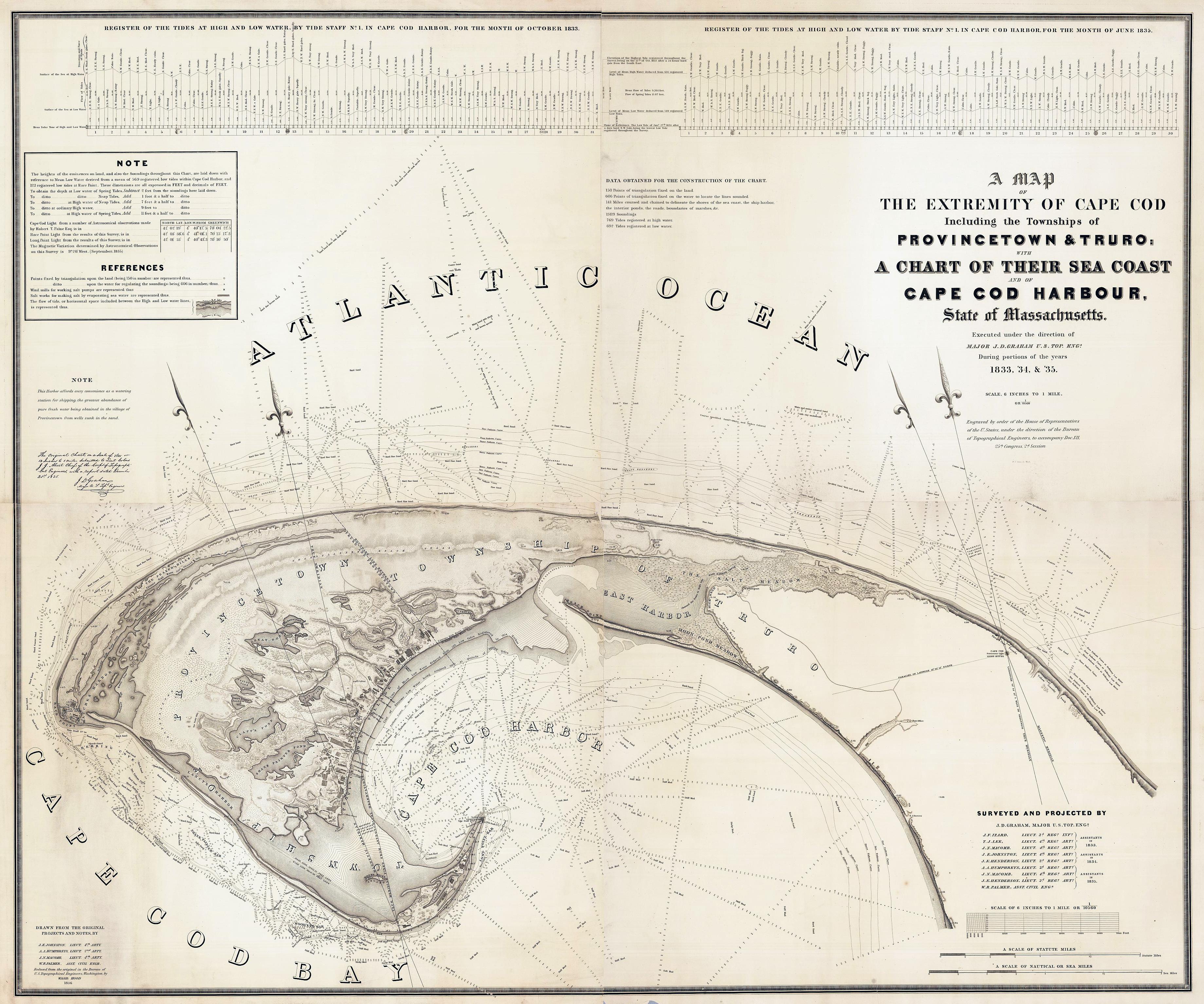
Provincetown US Topographical Bureau. Title Map Of The Extremity Of Cape Cod Including the Townships of Provincetown Truro Chart Of Their Sea Coast And Of Cape Cod Harbour State of Massachusetts Executed under the direction of Major Graham Top Engs During portions of the years ' ' Stone Sc Wash Surveyed And Projected By Graham