
Related Images

Download:
| Tiny | 104x128 | View | Download |
| Small | 209x256 | View | Download |
| Medium | 418x512 | View | Download |
| Large | 837x1024 | View | Download |
| Original | 5000x6111 | View | Download |
This image was acquired from
wikimedia. It was marked as Public Domain or CC0 and is free to use. To verify, go to the source and check the information there.
Looking for more info about this image?
Try a Google Reverse Image Search for it.
Try a Google Reverse Image Search for it.
Keywords from Image Description:
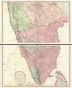
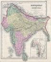
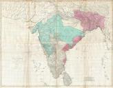
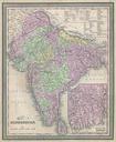
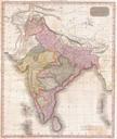
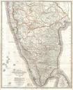
Wyld Wall Map of India Hindostan or British India Geographicus Indiawyld. This stunning wall map of India dating to is James Wyld's reissued of William Faden's important map of the same region This is one of the largest and most impressive maps of India to emerge in the th century This chart depicts the subcontinent from Bombay