
Related Images


Download:
| Tiny | 107x128 | View | Download |
| Small | 215x256 | View | Download |
| Medium | 431x512 | View | Download |
| Large | 862x1024 | View | Download |
| Original | 2947x3500 | View | Download |
This image was acquired from
wikimedia. It was marked as Public Domain or CC0 and is free to use. To verify, go to the source and check the information there.
Looking for more info about this image?
Try a Google Reverse Image Search for it.
Try a Google Reverse Image Search for it.
Keywords from Image Description:
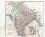
Clement Crutwell Map of Hindoostan Geographicus Indiacruttwell. fine map India here labeled Hindoostan by the English map publisher Clement Cruttwell Covers the entire subcontinent and is divided into the various princely states Though there is no specific reference to British dominance in the region most of India had at this