
Related Images


Download:
| Tiny | 104x128 | View | Download |
| Small | 209x256 | View | Download |
| Medium | 419x512 | View | Download |
| Large | 838x1024 | View | Download |
| Original | 2865x3500 | View | Download |
This image was acquired from
wikimedia. It was marked as Public Domain or CC0 and is free to use. To verify, go to the source and check the information there.
Looking for more info about this image?
Try a Google Reverse Image Search for it.
Try a Google Reverse Image Search for it.
Keywords from Image Description:
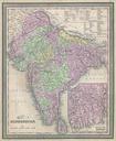
Mitchell Map of India Geographicus Hindoostanmitchell. An extremely attractive example of Mitchell Sr map of India Covers the subcontinent in considerable detail Princely states and British possessions are color coded An inset in the lower right hand quadrant details the Delta of the Ganges River Surrounded by the green border