
Related Images


Download:
| Tiny | 158x128 | View | Download |
| Small | 316x256 | View | Download |
| Medium | 633x512 | View | Download |
| Large | 1266x1024 | View | Download |
| Original | 4000x3234 | View | Download |
This image was acquired from
wikimedia. It was marked as Public Domain or CC0 and is free to use. To verify, go to the source and check the information there.
Looking for more info about this image?
Try a Google Reverse Image Search for it.
Try a Google Reverse Image Search for it.
Keywords from Image Description:
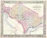
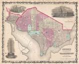
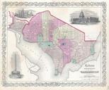
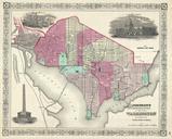
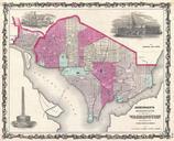
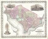
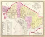
Mitchell Map of Washington D.C. Georgetown Geographicus WashingtonDCm. This is beautiful hand colored map of Washington Capital of the United States The map covers all of Washington as well as parts of adjacent Georgetown The whole is highly detailed with individual buildings noted and color coding to define city wards Some