
Related Images
Download:
| Tiny | 86x128 | View | Download |
| Small | 172x256 | View | Download |
| Medium | 345x512 | View | Download |
| Large | 691x1024 | View | Download |
| Original | 2701x4000 | View | Download |
This image was acquired from
wikimedia. It was marked as Public Domain or CC0 and is free to use. To verify, go to the source and check the information there.
Looking for more info about this image?
Try a Google Reverse Image Search for it.
Try a Google Reverse Image Search for it.
Keywords from Image Description:
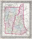
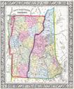
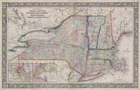
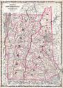
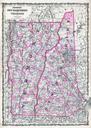
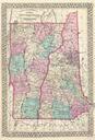
Mitchell Map of Vermont and New Hampshire Geographicus VTNHmitchell. beautiful example of Mitchell Jr map of Vermont and New Hampshire Denotes both political and geographical details Divided according to counties and highlighted with Mitchell typical pastels One of the most attractive American atlas maps of this region to appear