
Related Images


Download:
| Tiny | 110x128 | View | Download |
| Small | 220x256 | View | Download |
| Medium | 441x512 | View | Download |
| Large | 883x1024 | View | Download |
| Original | 2587x3000 | View | Download |
This image was acquired from
wikimedia. It was marked as Public Domain or CC0 and is free to use. To verify, go to the source and check the information there.
Looking for more info about this image?
Try a Google Reverse Image Search for it.
Try a Google Reverse Image Search for it.
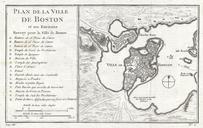
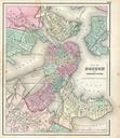
Keywords from Image Description:
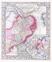
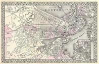
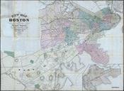
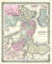
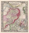
Mitchell Map of Boston Massachusetts Geographicus Bostonmitchel. beautiful example of Mitchell Junior map of Boston Massachusetts Depicts Boston along with parts of East Cambridge Charlestown East Boston and South Boston Offers wonderful detail at the street level including references to parks individual streets trains piers ferries