
Related Images


Download:
| Tiny | 146x128 | View | Download |
| Small | 292x256 | View | Download |
| Medium | 584x512 | View | Download |
| Large | 1168x1024 | View | Download |
| Original | 3008x2636 | View | Download |
This image was acquired from
wikimedia. It was marked as Public Domain or CC0 and is free to use. To verify, go to the source and check the information there.
Looking for more info about this image?
Try a Google Reverse Image Search for it.
Try a Google Reverse Image Search for it.
Keywords from Image Description:
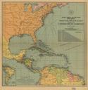
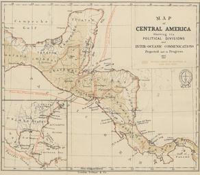
map of Central America showing its political divisions. en Map of Central America taken from page of Honduras descriptive historical and statistical British Library HMNTS pp being reprint of the chapters on Honduras contained in the book The States of Central America British Library image Ephraim George Squier no known