Related Images
Download:
| Tiny | 141x128 | View | Download |
| Small | 282x256 | View | Download |
| Medium | 564x512 | View | Download |
| Large | 1128x1024 | View | Download |
| Original | 7813x7090 | View | Download |
This image was acquired from
wikimedia. It was marked as Public Domain or CC0 and is free to use. To verify, go to the source and check the information there.
Looking for more info about this image?
Try a Google Reverse Image Search for it.
Try a Google Reverse Image Search for it.
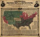
Keywords from Image Description:
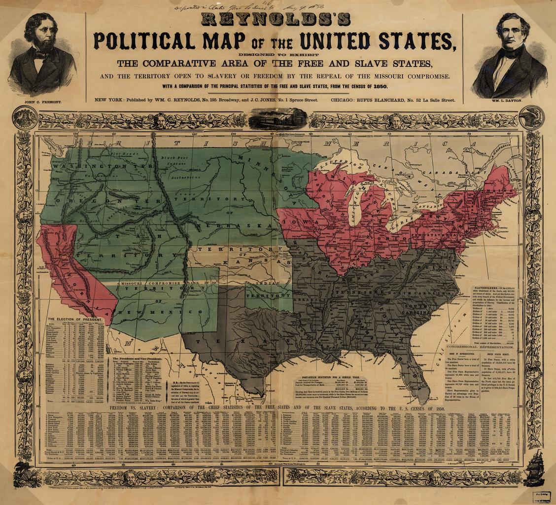
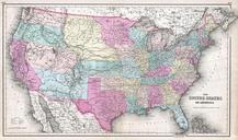
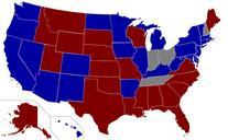
Reynolds's Political Map of the United States . LargeImage US map shows free and slave states and populations this is Reynolds's Political Map of the United States from Library of Congress collection loc gov html loc gov gmd ct Reynolds's Political Map of the United States from the Library of Congress Geography and Map Division