Related Images


Download:
| Tiny | 151x128 | View | Download |
| Small | 302x256 | View | Download |
| Medium | 604x512 | View | Download |
| Large | 1209x1024 | View | Download |
| Original | 4777x4045 | View | Download |
This image was acquired from
wikimedia. It was marked as Public Domain or CC0 and is free to use. To verify, go to the source and check the information there.
Looking for more info about this image?
Try a Google Reverse Image Search for it.
Try a Google Reverse Image Search for it.
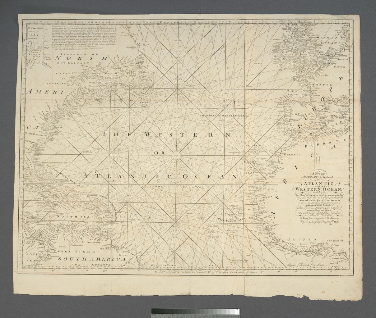
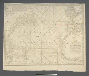
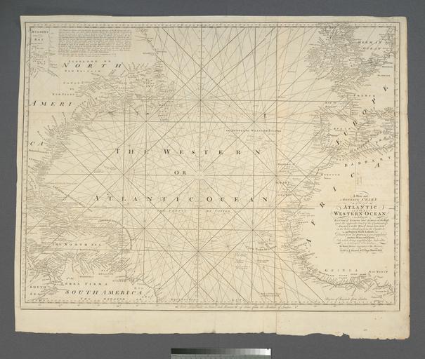
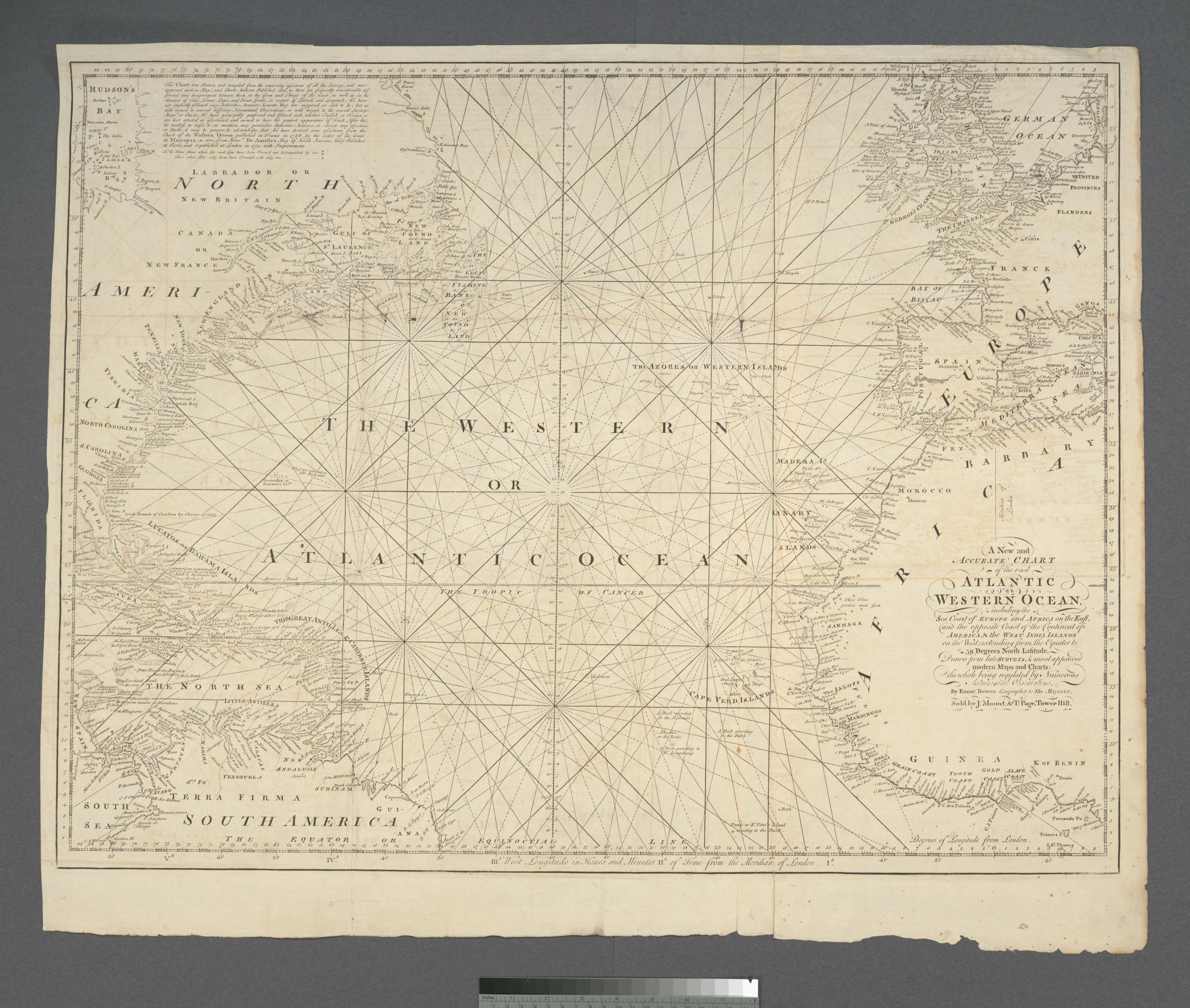
Keywords from Image Description:
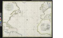
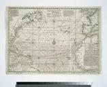
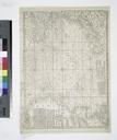
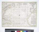
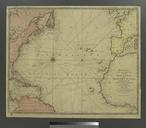
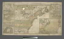
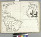
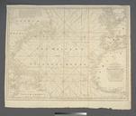
A new and accurate chart of the vast Atlantic or Western Ocean NYPL b. en Depths shown by soundings in the Grand Banks of Newfoundland Shallow areas shown by stippling Appears in The English pilot The fourth book to eds Verner nypl org Scan by NYPL new and accurate chart of the vast Atlantic or Western Ocean Nautical charts