Related Images


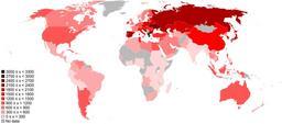
Download:
| Tiny | 195x128 | View | Download |
| Small | 391x256 | View | Download |
| Medium | 783x512 | View | Download |
| Large | 1567x1024 | View | Download |
| Original | 2417x1579 | View | Download |
This image was acquired from
wikimedia. It was marked as Public Domain or CC0 and is free to use. To verify, go to the source and check the information there.
Looking for more info about this image?
Try a Google Reverse Image Search for it.
Try a Google Reverse Image Search for it.
Keywords from Image Description:
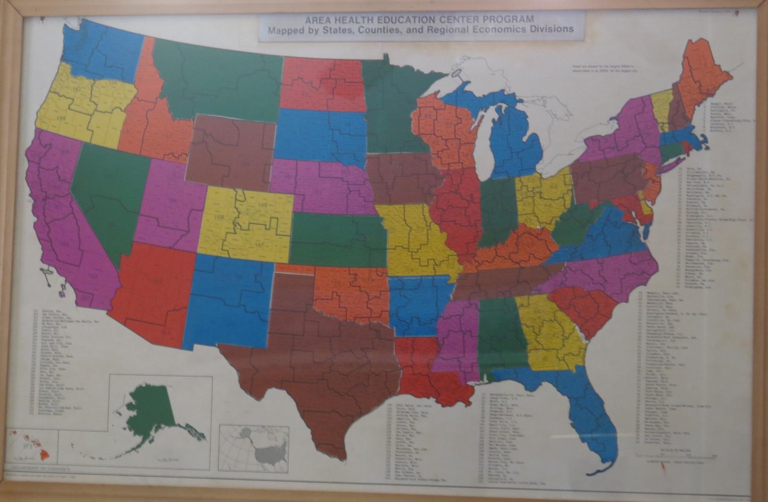
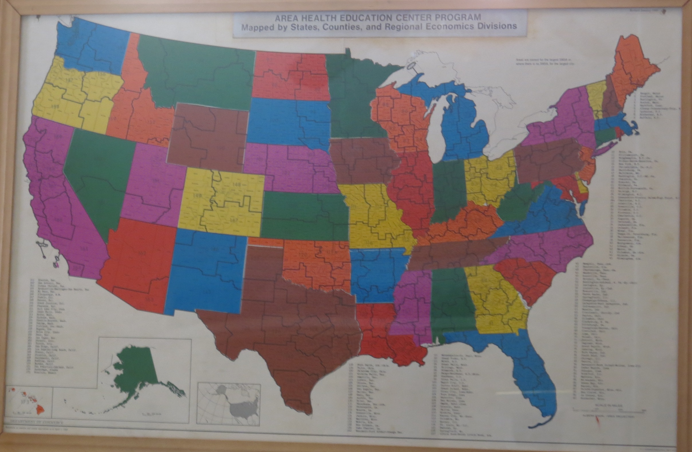
AHEC Program Map by US Printing Office. en GPO map showing states counties and regional economics divisions that was used for planning the AHEC program Personal Collection Daniel Smith former National AHEC Coordinator Government Printing Office other versions PDUSGov Maps of the United States