Related Images
Download:
| Tiny | 115x128 | View | Download |
| Small | 230x256 | View | Download |
| Medium | 460x512 | View | Download |
| Large | 920x1024 | View | Download |
| Original tiff | 4984x5547 | View | Download |
| Original as jpg | 4984x5547 | View | Download |
This image was acquired from
wikimedia. It was marked as Public Domain or CC0 and is free to use. To verify, go to the source and check the information there.
Looking for more info about this image?
Try a Google Reverse Image Search for it.
Try a Google Reverse Image Search for it.
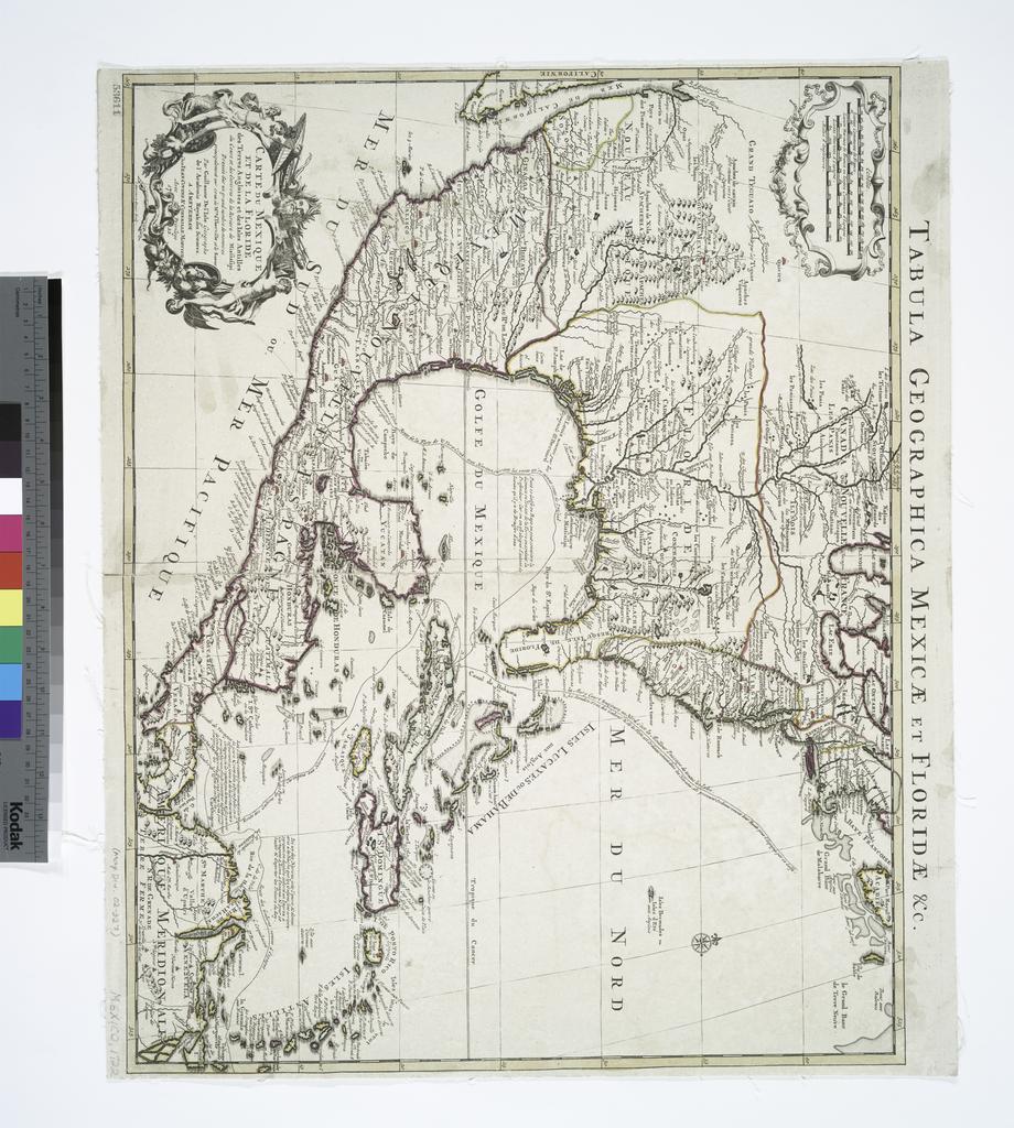
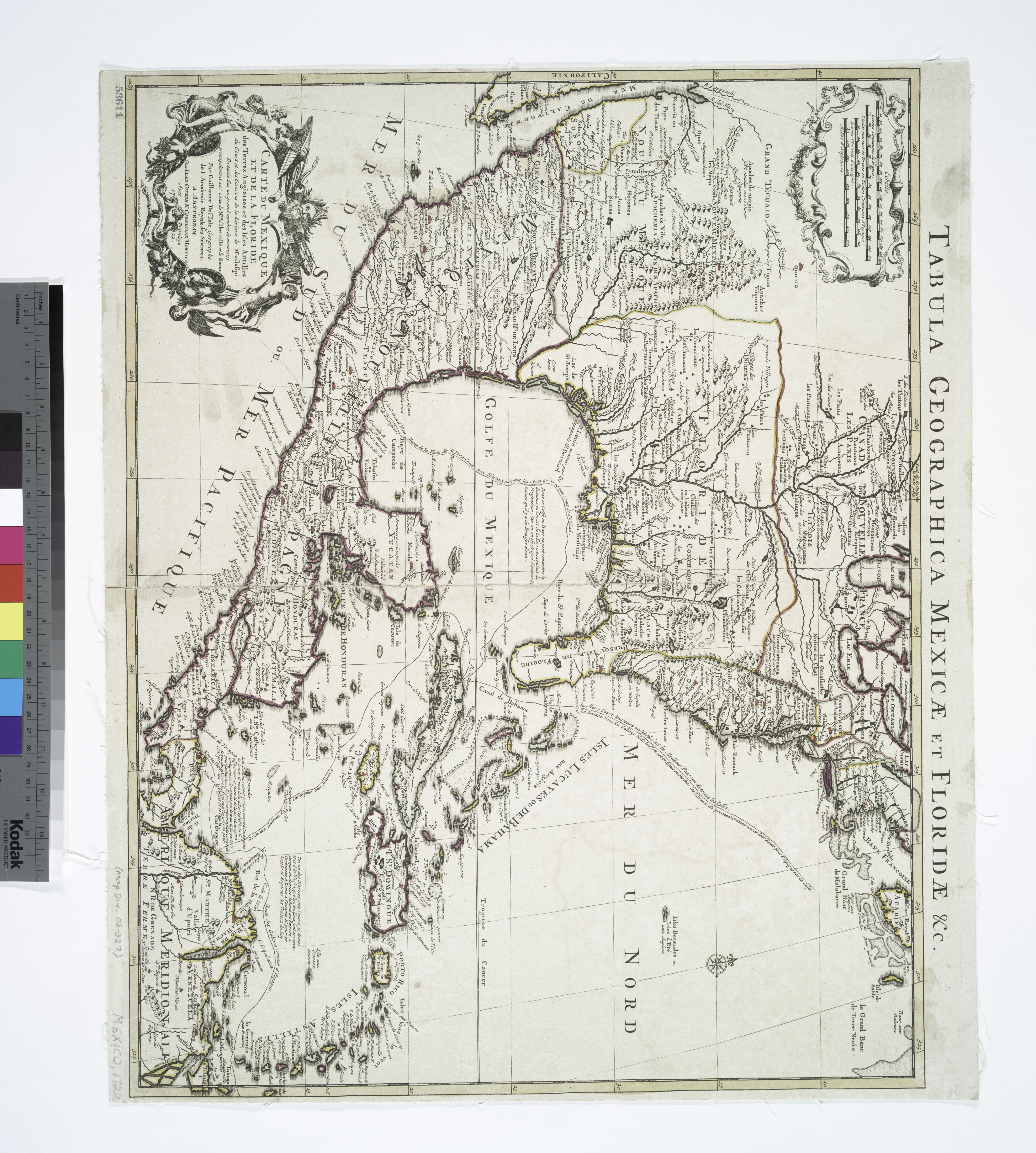
Keywords from Image Description:
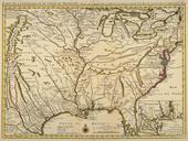
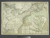
Carte du Mexique et de la Floride des terres angloises et des Isles Antilles du cours et des environs de la riviere de Mississipi dressee sur un grand nombre de memoires principalement sur ceux NYPL. NYPLmap Stemmers Engraver L'Isle Guillaume de Geographer not in Relator list Map Div updated nypl org cfm imageID Relief