
Related Images


Download:
| Tiny | 112x128 | View | Download |
| Small | 224x256 | View | Download |
| Medium | 449x512 | View | Download |
| Large | 899x1024 | View | Download |
| Original | 2242x2553 | View | Download |
This image was acquired from
wikimedia. It was marked as Public Domain or CC0 and is free to use. To verify, go to the source and check the information there.
Looking for more info about this image?
Try a Google Reverse Image Search for it.
Try a Google Reverse Image Search for it.
Keywords from Image Description:
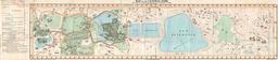
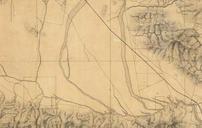
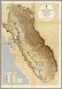
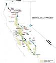
Central Valley Project Map from USBR . en Map of Central Valley Project Delta Mendota Canal in blue runs southwest to northeast in the central part of the map usbr gov Name Photo US Bureau of Reclamation other versions PDUSGov Central Valley of California