Related Images


Download:
| Tiny | 173x128 | View | Download |
| Small | 347x256 | View | Download |
| Medium | 695x512 | View | Download |
| Large | 1391x1024 | View | Download |
| Original tiff | 6035x4440 | View | Download |
| Original as jpg | 6035x4440 | View | Download |
This image was acquired from
wikimedia. It was marked as Public Domain or CC0 and is free to use. To verify, go to the source and check the information there.
Looking for more info about this image?
Try a Google Reverse Image Search for it.
Try a Google Reverse Image Search for it.
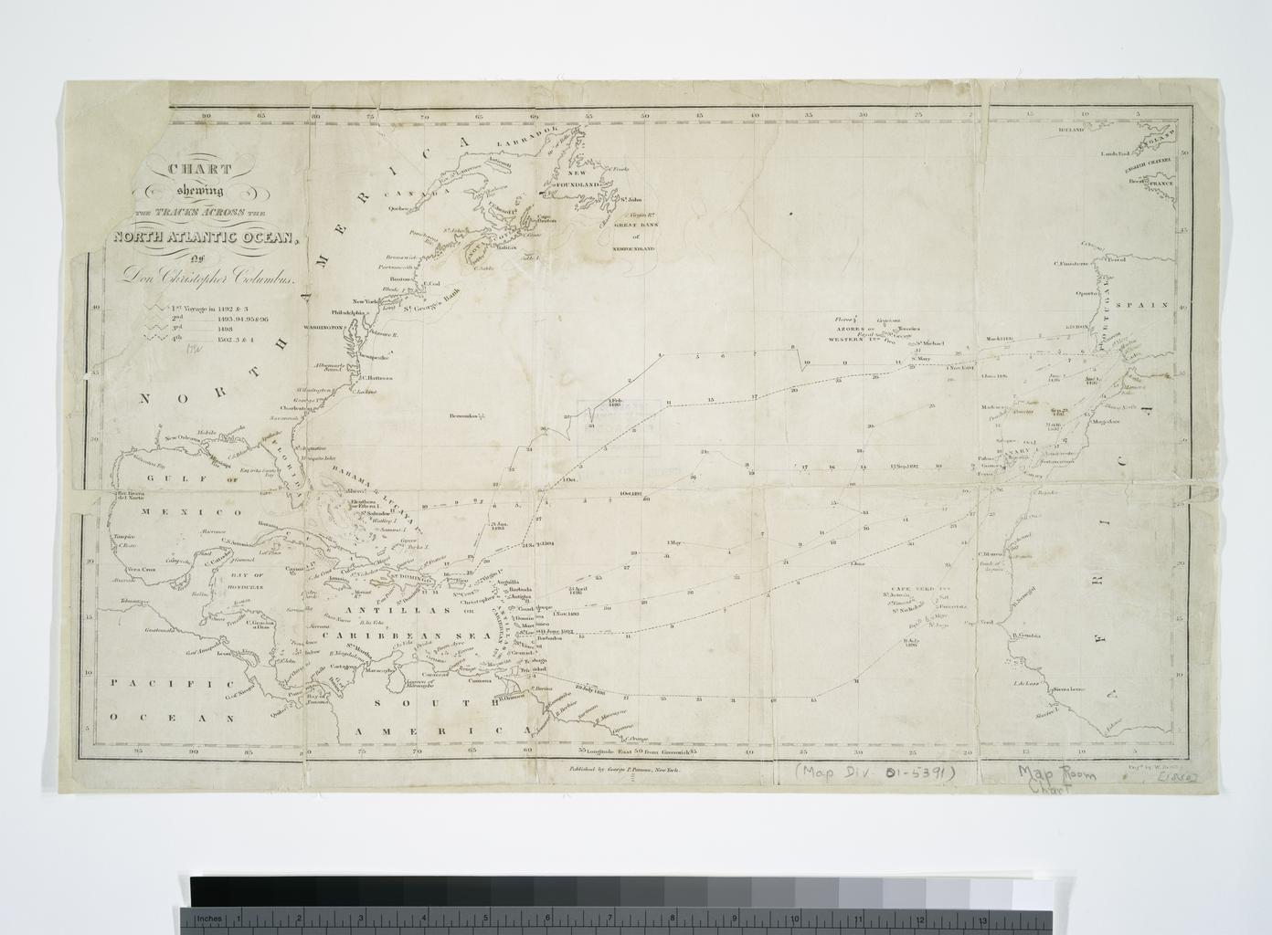
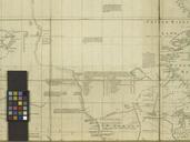
Keywords from Image Description:
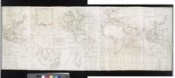
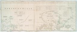
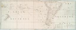
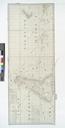
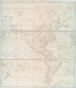
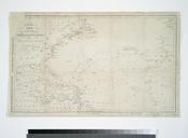
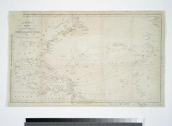
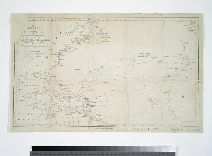
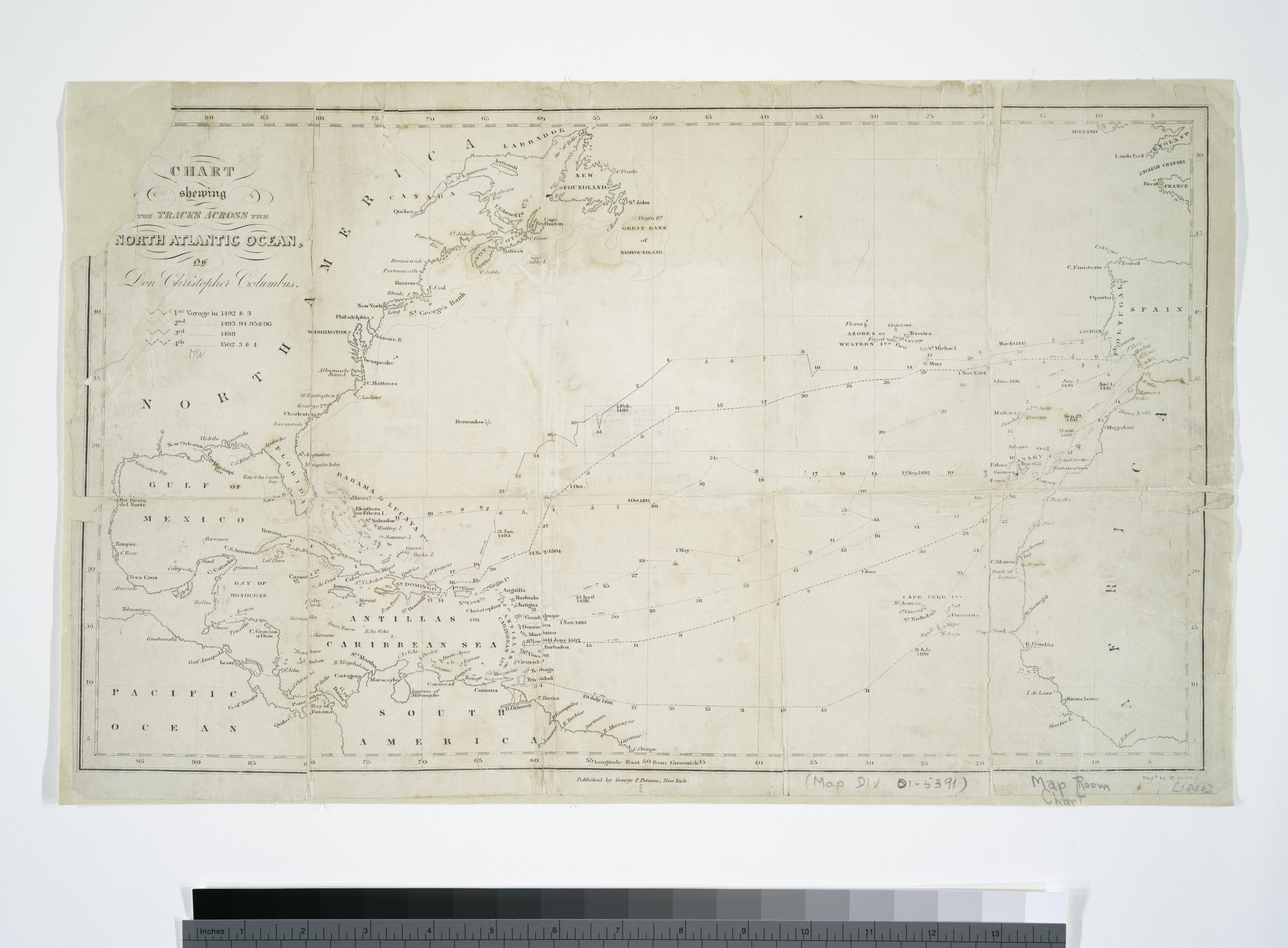
Chart shewing the tracks across the North Atlantic Ocean of Don Christopher Columbus eng'd by W. Kemble. NYPL. map cm Maps of the Oceans Atlantic Ocean Stephen Schwarzman Building The Lionel Pincus and Princess Firyal Map Division Putnam George Palmer Publisher Chart shewing the tracks across the North Atlantic Ocean of