
Related Images


Download:
| Tiny | 302x128 | View | Download |
| Small | 605x256 | View | Download |
| Medium | 1210x512 | View | Download |
| Large | 2421x1024 | View | Download |
| Original | 4730x2000 | View | Download |
This image was acquired from
wikimedia. It was marked as Public Domain or CC0 and is free to use. To verify, go to the source and check the information there.
Looking for more info about this image?
Try a Google Reverse Image Search for it.
Try a Google Reverse Image Search for it.
Keywords from Image Description:
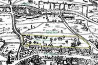
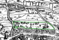
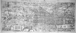
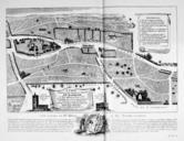
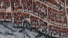
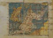
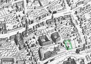
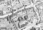
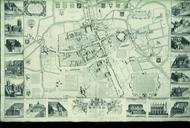
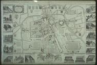
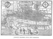
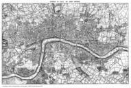
Civitas Londinium or The Agas Map of London. en The earliest proper map as opposed to panorama of London known Attributed to Ralph Agas and probably surveyed between and The original was foot inches long by feet inches wide This much reduced image is scan of copy of lithograph of copy was itself badly repaired with sellotape