
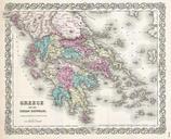
Related Images


Download:
| Tiny | 122x128 | View | Download |
| Original png | 157x164 | View | Download |
| Original as jpg | 157x164 | View | Download |
This image was acquired from
wikimedia. It was marked as Public Domain or CC0 and is free to use. To verify, go to the source and check the information there.
Looking for more info about this image?
Try a Google Reverse Image Search for it.
Try a Google Reverse Image Search for it.
Keywords from Image Description:
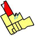
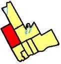
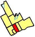
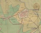
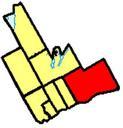
Durclr. map showing the towns and city borders within the Durham Region The red highlighted area represents Clarington Earl Andrew talk original upload date Earl Andrew talk Earl Andrew original upload log en Sreejithk CommonsHelper page en Durclr Earl Andrew bytes no Maps of Clarington Ontario Locator maps of Canada