
Related Images


Download:
| Tiny | 92x128 | View | Download |
| Small | 184x256 | View | Download |
| Medium | 369x512 | View | Download |
| Large | 739x1024 | View | Download |
| Original | 779x1079 | View | Download |
This image was acquired from
wikimedia. It was marked as Public Domain or CC0 and is free to use. To verify, go to the source and check the information there.
Looking for more info about this image?
Try a Google Reverse Image Search for it.
Try a Google Reverse Image Search for it.
Keywords from Image Description:
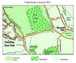
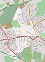
Fortis Green Ward map. en map of Fortis Green Ward in north London The original map is by Open Street Map and has been much modified with shading and additional road names added Open Street Map is map which states on their web site OpenStreetMap allows you to view edit and use geographical data in collaborative way from anywhere