
Related Images


Download:
| Tiny | 171x128 | View | Download |
| Small | 342x256 | View | Download |
| Medium | 684x512 | View | Download |
| Original | 1280x958 | View | Download |
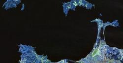
This image was acquired from
wikimedia. It was marked as Public Domain or CC0 and is free to use. To verify, go to the source and check the information there.
Looking for more info about this image?
Try a Google Reverse Image Search for it.
Try a Google Reverse Image Search for it.
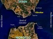
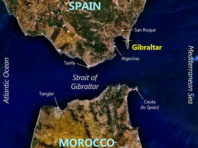
Keywords from Image Description:
Gibraltar World Wind view annotated. Annotated satellite map of Gibraltar and surrounding area NASA NASA World Wind image Prioryman annotations Derivative from File Strait of Gibraltar Satellite images of Gibraltar Cczero PDWorldWind Check categories July Acciona Trasmediterrnea