
Related Images


Download:
| Tiny | 153x128 | View | Download |
| Small | 306x256 | View | Download |
| Medium | 613x512 | View | Download |
| Original | 709x592 | View | Download |
This image was acquired from
wikimedia. It was marked as Public Domain or CC0 and is free to use. To verify, go to the source and check the information there.
Looking for more info about this image?
Try a Google Reverse Image Search for it.
Try a Google Reverse Image Search for it.
Keywords from Image Description:
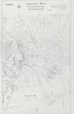
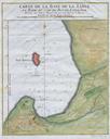
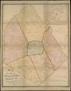
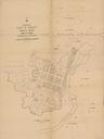
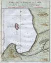
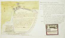
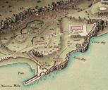
Hardy Town map. Extract from Plan de Gibraltar showing the Hardy Town encampment and the area around Rosia Bay bnf fr Bibliothque nationale de France dpartement Cartes et plans GE JeanDenis Barbi du Bocage PDold Old maps of Gibraltar GibraltarpediA South Mole Gibraltar Rosia Bay Gibraltar Camp Bay Gibraltar maps