
Related Images


Download:
| Tiny | 133x128 | View | Download |
| Small | 267x256 | View | Download |
| Original gif | 300x287 | View | Download |
| Original as jpg | 300x287 | View | Download |
This image was acquired from
wikimedia. It was marked as Public Domain or CC0 and is free to use. To verify, go to the source and check the information there.
Looking for more info about this image?
Try a Google Reverse Image Search for it.
Try a Google Reverse Image Search for it.
Keywords from Image Description:
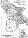
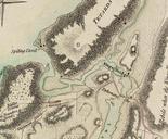
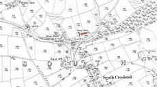
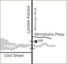
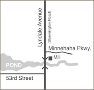
LocationofRichlandMill. Map showing location of the Richland Mill on Minnehaha Creek and Lyndale Avenue Bloomington Road in the Township of Richfield Present day in the boundaries of Minneapolis Minnesota Map illustration by Joe Hoover for book Richfield Minnesota's Oldest Suburb published by the Richfield Historical Society Reproduced