
Related Images

Download:
| Tiny | 173x128 | View | Download |
| Small | 347x256 | View | Download |
| Medium | 694x512 | View | Download |
| Large | 1388x1024 | View | Download |
| Original | 1923x1418 | View | Download |
This image was acquired from
wikimedia. It was marked as Public Domain or CC0 and is free to use. To verify, go to the source and check the information there.
Looking for more info about this image?
Try a Google Reverse Image Search for it.
Try a Google Reverse Image Search for it.
Keywords from Image Description:
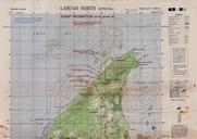
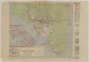
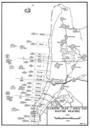
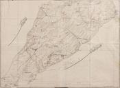
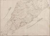
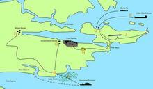
Map of southern Labuan marked with estimated Japanese positions and Allied invasion beaches as of April . An Allied map of the southern portion of Labuan Island in modern Malaysia marked with the positions which Allied intelligence believed that the island's Japanese garrison was occupying as at April Battalion official War Diary