Related Images


Download:
| Tiny | 207x128 | View | Download |
| Small | 414x256 | View | Download |
| Medium | 828x512 | View | Download |
| Original svg | 959x593 | View | Download |
| Original as jpg | 959x593 | View | Download |
This image was acquired from
wikimedia. It was marked as Public Domain or CC0 and is free to use. To verify, go to the source and check the information there.
Looking for more info about this image?
Try a Google Reverse Image Search for it.
Try a Google Reverse Image Search for it.
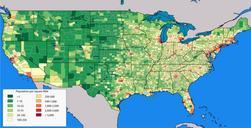
Keywords from Image Description:
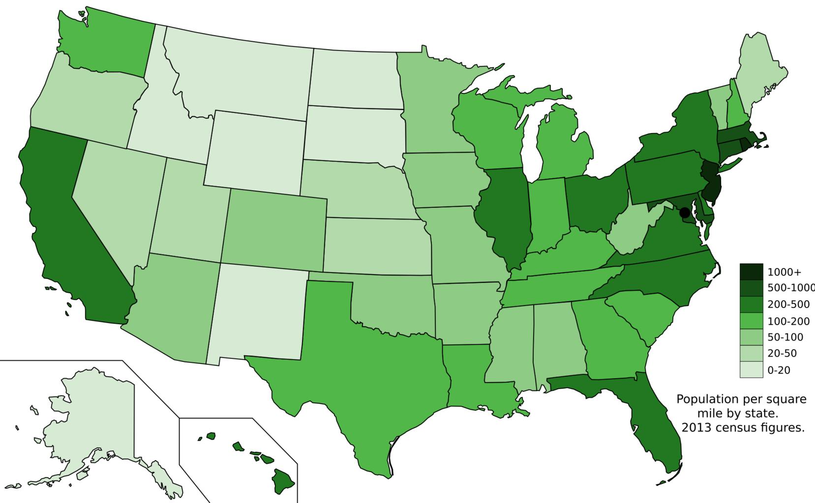
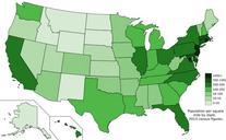
Map of states showing population density in .svg en The US states with population density shown by people per square mile from the census based on data from census gov csv USCB own Map is based on here Ali Zifan other versions cczero Uploaded with Maps of the United States