
Related Images


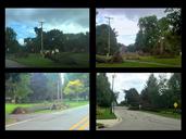


Download:
| Tiny | 247x128 | View | Download |
| Small | 494x256 | View | Download |
| Medium | 988x512 | View | Download |
| Original png | 1035x536 | View | Download |
| Original as jpg | 1035x536 | View | Download |
This image was acquired from
wikimedia. It was marked as Public Domain or CC0 and is free to use. To verify, go to the source and check the information there.
Looking for more info about this image?
Try a Google Reverse Image Search for it.
Try a Google Reverse Image Search for it.
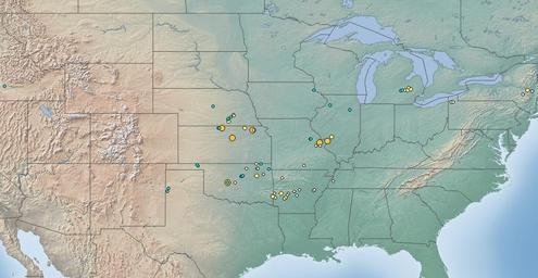
Keywords from Image Description:
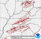
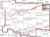
May tornado outbreak map. en This map depicts the starting locations of tornadoes which occurred during the May tornado outbreak for which the information is available This map was created with QGIS and it uses information provided by the National Oceanic and Atmospheric Administration own Dustin Cczero Maps of North Americian