
Related Images


Download:
| Tiny | 156x128 | View | Download |
| Small | 313x256 | View | Download |
| Medium | 627x512 | View | Download |
| Original png | 852x695 | View | Download |
| Original as jpg | 852x695 | View | Download |
This image was acquired from
wikimedia. It was marked as Public Domain or CC0 and is free to use. To verify, go to the source and check the information there.
Looking for more info about this image?
Try a Google Reverse Image Search for it.
Try a Google Reverse Image Search for it.
Keywords from Image Description:
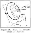
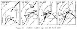
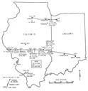
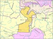
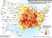
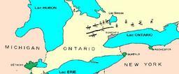
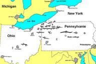
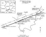
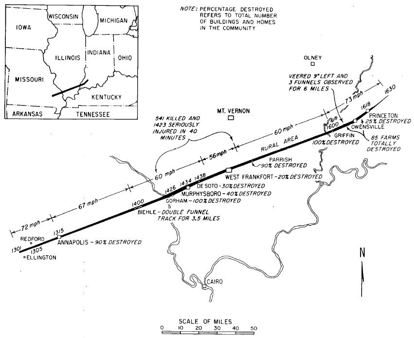
TriState Tornado map. Original track map of the mile hour TriState Tornado which killed in Missouri Illinois and Indiana on March Wilson John and Stanley Changnon Jr Illinois Tornadoes Circular Illinois State Water Survey UrbanaChampaign IL PDUSGov Tornado track maps