
Related Images


Download:
| Tiny | 310x128 | View | Download |
| Small | 621x256 | View | Download |
| Original png | 1076x443 | View | Download |
| Original as jpg | 1076x443 | View | Download |
This image was acquired from
wikimedia. It was marked as Public Domain or CC0 and is free to use. To verify, go to the source and check the information there.
Looking for more info about this image?
Try a Google Reverse Image Search for it.
Try a Google Reverse Image Search for it.
Keywords from Image Description:
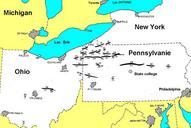
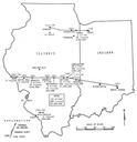
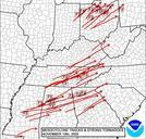
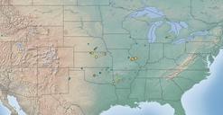
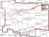
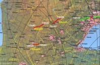
Tornado Outbreak map Ontario. en French version from map in on erh noaa gov pdf NOAA report showing the track of tornadoes in Ontario during the May st Outbreak Under is the area affected corresponding to the numbers on the map fr Version franaise de la carte erh noaa gov pdf du rapport de la NOAA pour les tornades en Ontario