
Related Images


Download:
| Tiny | 184x128 | View | Download |
| Small | 368x256 | View | Download |
| Medium | 736x512 | View | Download |
| Original | 760x528 | View | Download |
This image was acquired from
wikimedia. It was marked as Public Domain or CC0 and is free to use. To verify, go to the source and check the information there.
Looking for more info about this image?
Try a Google Reverse Image Search for it.
Try a Google Reverse Image Search for it.
Keywords from Image Description:
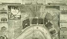
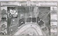
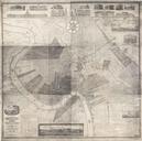
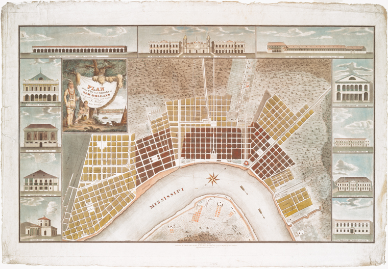
NewOrleansRollinsonMapNYPL.jpeg Plan of the city and suburbs of New Orleans from an actual survey Map with small illustrations of notable buildings in the city Halle des boucheries construite en l'anne Htel de ville construite en l'anne glise paroissialle construite en Presbytre anne Hpital militaire et casernes construites