Related Images


Download:
| Tiny | 202x128 | View | Download |
| Small | 405x256 | View | Download |
| Medium | 811x512 | View | Download |
| Original | 1146x723 | View | Download |
This image was acquired from
wikimedia. It was marked as Public Domain or CC0 and is free to use. To verify, go to the source and check the information there.
Looking for more info about this image?
Try a Google Reverse Image Search for it.
Try a Google Reverse Image Search for it.
Keywords from Image Description:
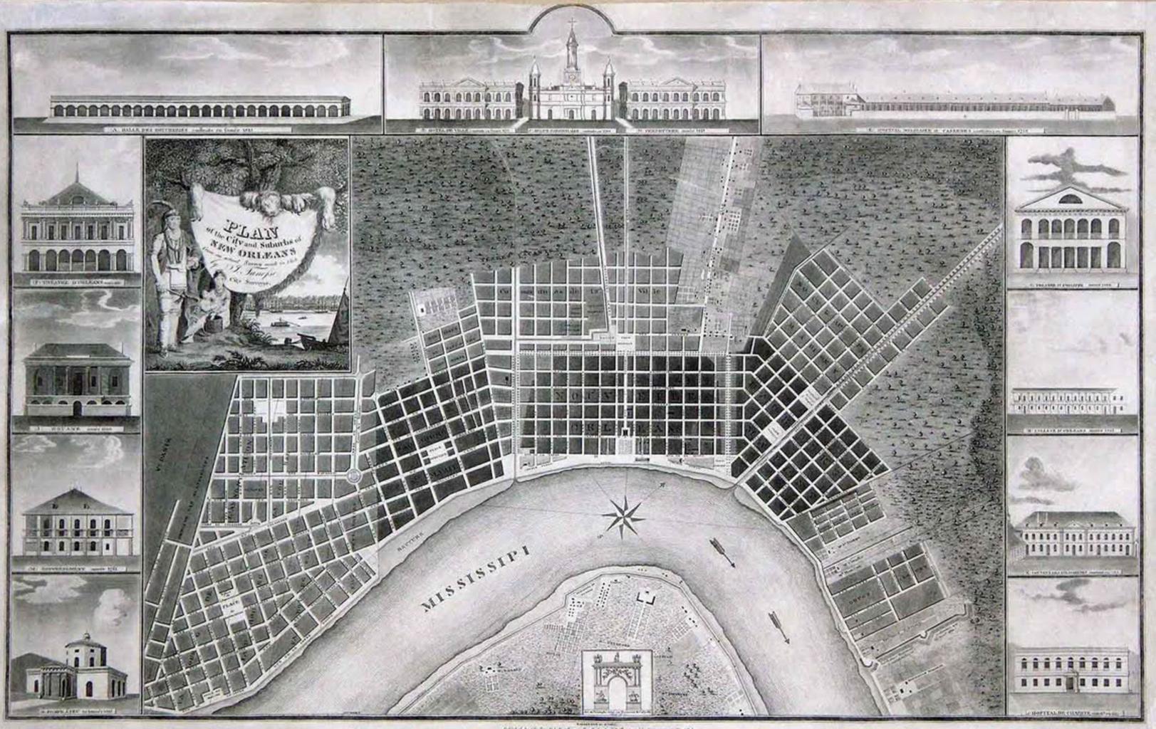
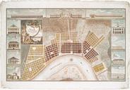
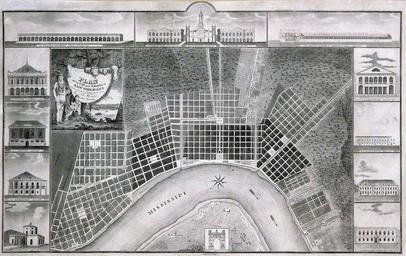
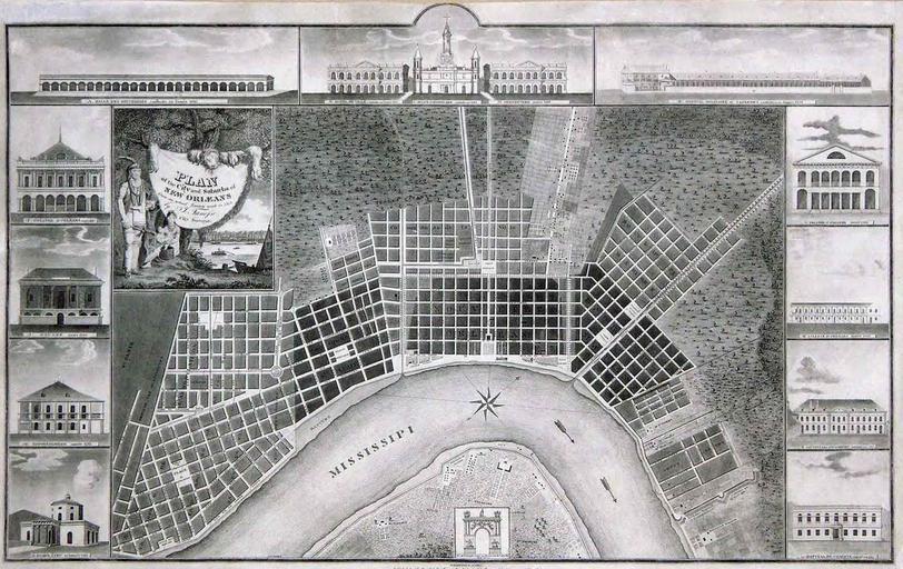
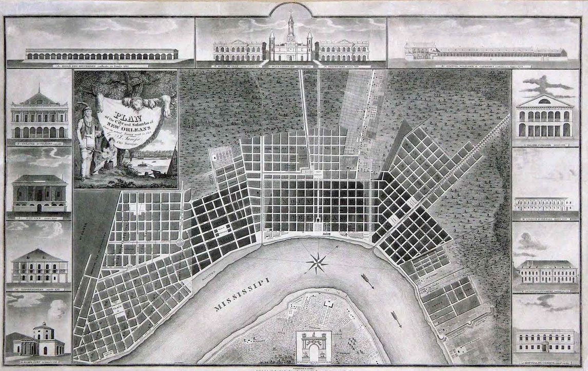
Tanesse NewOrleans Map printing. Jacques Tanesse Plan of New Orleans illustrated map of New Orleans This was actually reprinting of map from decade earlier with some additions notably the temporary triumphal arch illustrated at bottom center which was erected in the Place d'Armes to celebrate the visit to the city of General Lafayette