
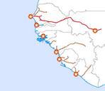
Related Images


Download:
| Tiny | 202x128 | View | Download |
| Original png | 401x254 | View | Download |
| Original as jpg | 401x254 | View | Download |
This image was acquired from
wikimedia. It was marked as Public Domain or CC0 and is free to use. To verify, go to the source and check the information there.
Looking for more info about this image?
Try a Google Reverse Image Search for it.
Try a Google Reverse Image Search for it.
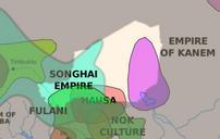
Keywords from Image Description:
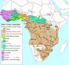
Niger civilizations map precolonial. Map showing Medieval African civilizations cented on the moder borders of Niger selfmade using The Gimp and Image Africa map politicalfr svg Image Africancivilizationsmapprecolonial svg Miles Public domain Maps of the history of Niger