
Related Images


Download:
| Tiny | 247x128 | View | Download |
| Small | 494x256 | View | Download |
| Medium | 988x512 | View | Download |
| Original png | 1035x536 | View | Download |
| Original as jpg | 1035x536 | View | Download |
This image was acquired from
wikimedia. It was marked as Public Domain or CC0 and is free to use. To verify, go to the source and check the information there.
Looking for more info about this image?
Try a Google Reverse Image Search for it.
Try a Google Reverse Image Search for it.
Keywords from Image Description:
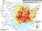
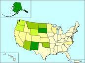
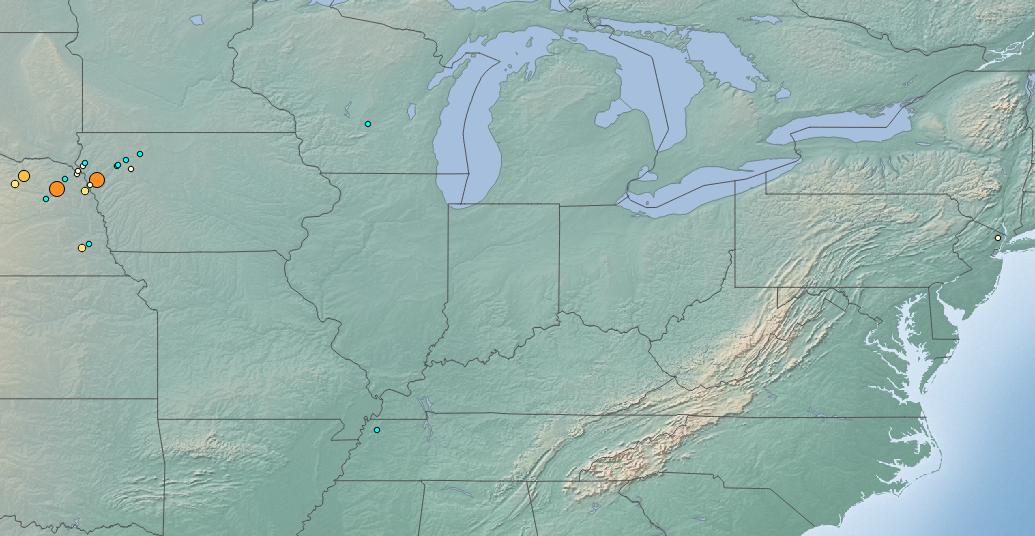
October North American storm complex tornado map. en This map depicts the locations of tornadoes which occurred with storm system which crossed much of the United States and nearby areas in early October of The tornado locations have been plotted with QGIS through the use of data provided by the National Oceanic and Atmospheric