
Related Images


Download:
| Tiny | 93x128 | View | Download |
| Small | 187x256 | View | Download |
| Medium | 374x512 | View | Download |
| Large | 749x1024 | View | Download |
| Original png | 1788x2444 | View | Download |
| Original as jpg | 1788x2444 | View | Download |
This image was acquired from
wikimedia. It was marked as Public Domain or CC0 and is free to use. To verify, go to the source and check the information there.
Looking for more info about this image?
Try a Google Reverse Image Search for it.
Try a Google Reverse Image Search for it.
Keywords from Image Description:
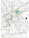
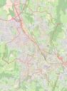
Plan Chambry Open Street Map. French commune of Chambry head of department Savoie in mid fr Carte de la commune franaise de Chambry cheflieu du dpartement de la Savoie au milieu de l'anne openstreetmap org map OpenStreetMap OpenStreetMap contributors Contributeurs OpenStreetMap no OpenStreetMap data and maps are under the