
Related Images


Download:
| Tiny | 172x128 | View | Download |
| Small | 345x256 | View | Download |
| Original png | 640x474 | View | Download |
| Original as jpg | 640x474 | View | Download |
This image was acquired from
wikimedia. It was marked as Public Domain or CC0 and is free to use. To verify, go to the source and check the information there.
Looking for more info about this image?
Try a Google Reverse Image Search for it.
Try a Google Reverse Image Search for it.
Keywords from Image Description:
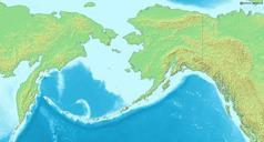
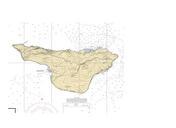
ProvideniyaLocator. Map of en Bering Sea National borders between Alaska Canada and the continental United States are shown Bounding box West South East North Modified with red dot in location of Provideniya cropped LABeringSea UTC LABeringSea LA derivative work dankarl marked Provideniya location Dankarl LABeringSea PDDemis