
Related Images
Download:
| Tiny | 140x128 | View | Download |
| Small | 280x256 | View | Download |
| Medium | 560x512 | View | Download |
| Original | 654x597 | View | Download |
This image was acquired from
wikimedia. It was marked as Public Domain or CC0 and is free to use. To verify, go to the source and check the information there.
Looking for more info about this image?
Try a Google Reverse Image Search for it.
Try a Google Reverse Image Search for it.
Keywords from Image Description:
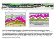
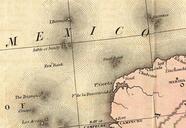
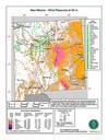
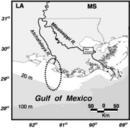
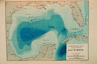
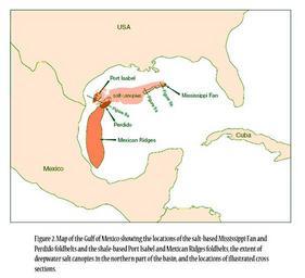
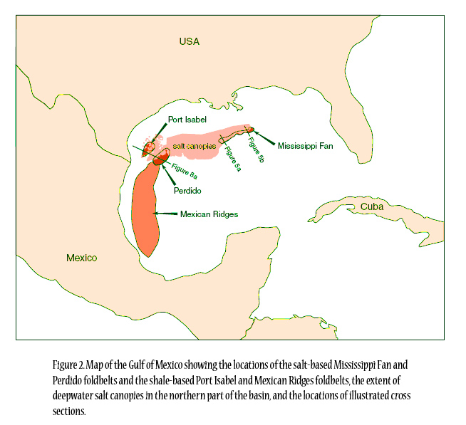
Saltdeposition. en Figure Map of the Gulf of Mexico showing the locations of the saltbased Mississippi Fan and Perdido foldbelts and the shalebased Port Isabel and Mexican Ridges foldbelts the extent of deepwater salt canopies in the northern part of the basin and the locations of illustrated cross sections beg utexas edu PDF