Related Images


Download:
| Tiny | 171x128 | View | Download |
| Small | 343x256 | View | Download |
| Medium | 686x512 | View | Download |
| Large | 1373x1024 | View | Download |
| Original | 3636x2711 | View | Download |
This image was acquired from
wikimedia. It was marked as Public Domain or CC0 and is free to use. To verify, go to the source and check the information there.
Looking for more info about this image?
Try a Google Reverse Image Search for it.
Try a Google Reverse Image Search for it.
Keywords from Image Description:
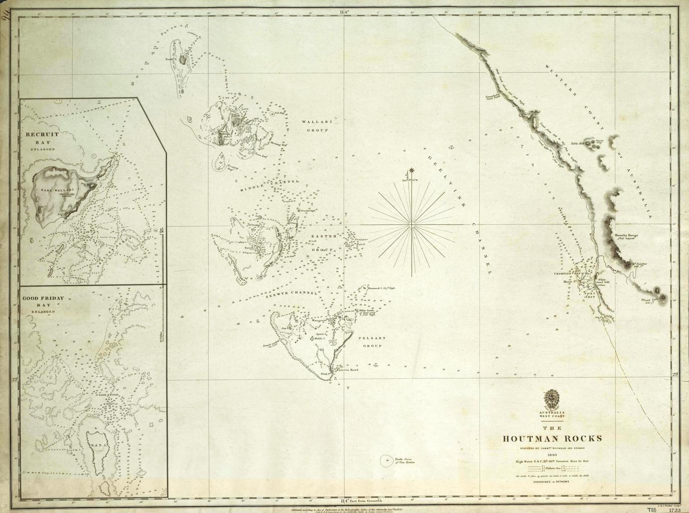
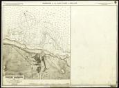
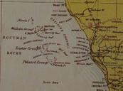
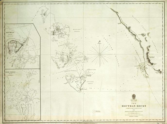
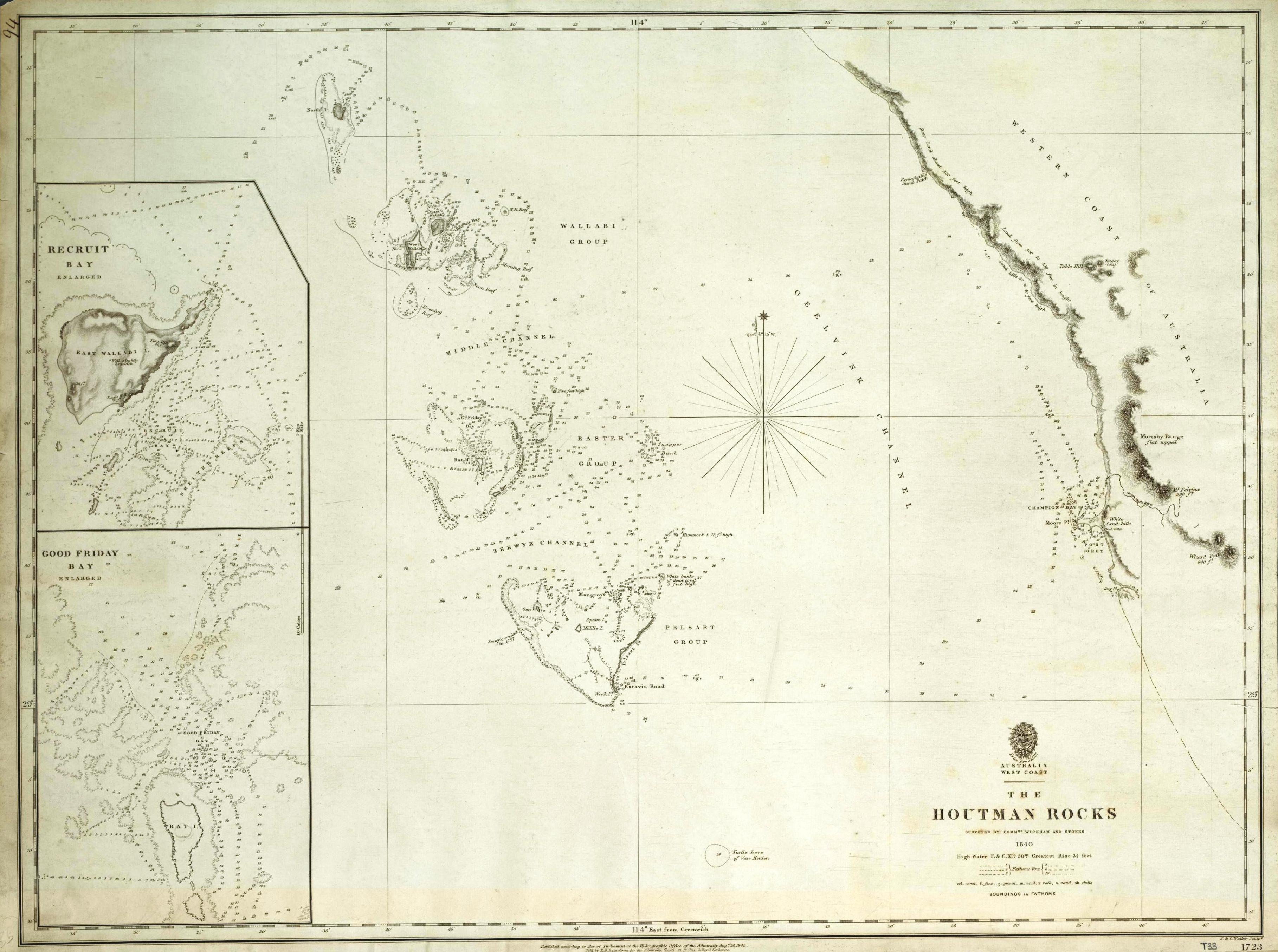
The Houtman Rocks British Admiralty Chart . This is an image of British Admiralty Chart entitled The Houtman Rocks It shows an archipelago off the west coast of Australia now known as the Houtman Abrolhos This map was published in based on survey undertaken by John Clements Wickham and John Lort Stokes on board HMS Beagle in This