
Related Images


Download:
| Tiny | 165x128 | View | Download |
| Small | 331x256 | View | Download |
| Medium | 662x512 | View | Download |
| Original | 1056x816 | View | Download |
This image was acquired from
wikimedia. It was marked as Public Domain or CC0 and is free to use. To verify, go to the source and check the information there.
Looking for more info about this image?
Try a Google Reverse Image Search for it.
Try a Google Reverse Image Search for it.
Keywords from Image Description:
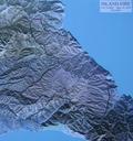
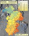
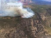
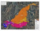
TrigoFireMapUSFS. en Map of the Trigo Fire in New Mexico showing the area burned daybyday from April through May Prepared by Max Wahlberg GIS Specialist Southwest Area Incident Management Team One Southwest Coordination Center SWCC an interagency coordinating group within the Federal goverment downloaded from inciweb org inciweb