
Related Images


Download:
| Tiny | 112x128 | View | Download |
| Small | 225x256 | View | Download |
| Medium | 450x512 | View | Download |
| Original png | 661x751 | View | Download |
| Original as jpg | 661x751 | View | Download |
This image was acquired from
wikimedia. It was marked as Public Domain or CC0 and is free to use. To verify, go to the source and check the information there.
Looking for more info about this image?
Try a Google Reverse Image Search for it.
Try a Google Reverse Image Search for it.
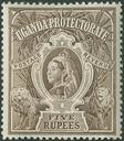
Keywords from Image Description:
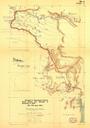
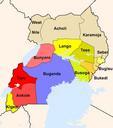
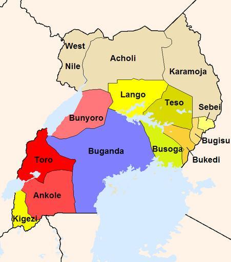
Uganda Protectorate British administration. The map shows the British administration units in the Uganda Protectorate borders of The reddish areas and the blue Buganda are areas where traditional kingdoms were maintained In the yellowish areas Bagandatype administration was introduced The khaki areas had no sole traditional rule