
Related Images


Download:
| Tiny | 200x128 | View | Download |
| Original gif | 261x167 | View | Download |
| Original as jpg | 261x167 | View | Download |
This image was acquired from
wikimedia. It was marked as Public Domain or CC0 and is free to use. To verify, go to the source and check the information there.
Looking for more info about this image?
Try a Google Reverse Image Search for it.
Try a Google Reverse Image Search for it.
Keywords from Image Description:
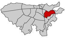
Uribe map historical. en Map of Uribealdea Uribe eskualdea in the context of historical formation of Biscay Red Uribealdea Orange other constituent districts of Biscay Yellow later incorporations Blue dots chartered towns and cities eu Uribe eskualde historikoaren planoa org Uribemaphistorical org Sugaar ko azaroaren Eskualdeak