
Related Images


Download:
| Tiny | 162x128 | View | Download |
| Small | 325x256 | View | Download |
| Medium | 651x512 | View | Download |
| Large | 1303x1024 | View | Download |
| Original | 2784x2187 | View | Download |
This image was acquired from
wikimedia. It was marked as Public Domain or CC0 and is free to use. To verify, go to the source and check the information there.
Looking for more info about this image?
Try a Google Reverse Image Search for it.
Try a Google Reverse Image Search for it.
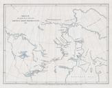
Keywords from Image Description:
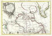
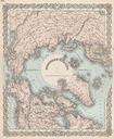
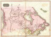
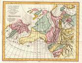
Murray Map of the Arctic Land Expedition Hudson Bay Canada Geographicus ArcticExpmurray. This hard to find map dating to was drawn by the Royal Geographical Society cartographer John Murray to illustrated the journal of the Arctic Land Expedition Depicts the parts of Canada north of Hudson Bay to Baffin Bay in the northeast and