
Related Images


Download:
| Tiny | 84x128 | View | Download |
| Small | 168x256 | View | Download |
| Medium | 336x512 | View | Download |
| Large | 673x1024 | View | Download |
| Original | 14863x22597 | View | Download |
This image was acquired from
wikimedia. It was marked as Public Domain or CC0 and is free to use. To verify, go to the source and check the information there.
Looking for more info about this image?
Try a Google Reverse Image Search for it.
Try a Google Reverse Image Search for it.
Keywords from Image Description:
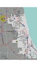
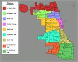
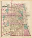
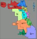
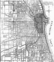
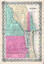
Chicago map by Henry Hart. LargeImage Map Henry Hart's City of Chicago published in was the largest and most detailed map up to that time and shows the footprints of individual buildings Formerly wallmap Cadastral map showing names of landowners names of streets railroads ward numbers and boundaries and other points of interest