
Related Images
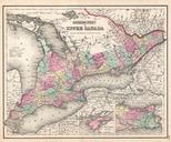
Download:
| Tiny | 153x128 | View | Download |
| Small | 306x256 | View | Download |
| Medium | 612x512 | View | Download |
| Large | 1224x1024 | View | Download |
| Original | 3500x2926 | View | Download |
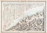
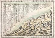
This image was acquired from
wikimedia. It was marked as Public Domain or CC0 and is free to use. To verify, go to the source and check the information there.
Looking for more info about this image?
Try a Google Reverse Image Search for it.
Try a Google Reverse Image Search for it.
Keywords from Image Description:
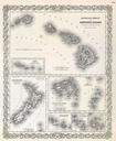
Colton Map or Comparative Chart of the World's Islands and Lakes Geographicus LakesIslandscolton. beautiful first edition example of Colton's curious topical chart of the world's great islands and lakes Divided into lakes and islands of the Eastern and Western Hemispheres Curiously does not include Greenland who's northern limits